Staff Spotlight: Hortensia Calvo, Christine Hernández, and Rachel Stein
Published

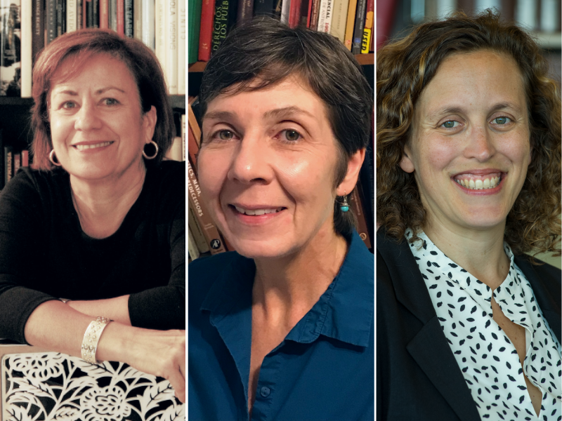
This summer, The Latin American Library (LAL) offered a satellite course for the University of Virginia’s Rare Book School (RBS)—a milestone in expanding the RBS curriculum to incorporate forms of writing, recording, and printing from Mexico and Central and South America. Dr. Hortensia Calvo, Doris Stone Librarian and Director of LAL; Dr. Christine Hernández, Curator of Special Collections at LAL; and Dr. Rachel Stein, LAL’s Research and Instruction Librarian; taught ‘Spanish American Textual Technologies to 1700’ to a class of twenty-one librarians, archivists, professors, and graduate students from academic institutions around the world.
Addressing a broad range of topics from stone inscriptions and painted texts to manual printing on the moveable-type press, the class explored the history of textual technologies in the region now referred to as Spanish America from the pre-contact era to the early colonial period (c. 300 BC to c. 1700 AD).
Showcasing LAL’s special collections and archives, Hortensia, Christine, and Rachel divided the course based on their areas of expertise. Hortensia focused on Renaissance European ideas about books and alphabetic writing at the moment of encounter. She led the class in discussions of language and “the book” as instruments of empire and how early modern Spaniards perceived indigenous writings they found in the New World.
“It was so interesting to discuss with the students the biases that early modern Europeans brought with them when they first encountered Amerindian texts and forms of writing. The students were very engaged and engaging; it was a truly enlightening experience that renewed my love of teaching.”
Rachel covered the printing press across the transatlantic Spanish Monarchy, highlighting the publishing centers of Mexico City, Puebla, Lima, Lisbon, Antwerp, and Madrid. As a hands-on activity, students uncovered clues about the printing process and the evolution of a manuscript to a published book. Rachel shared, “I wanted the students to come away with concrete knowledge they could use in their own teaching with rare books. I learned so much from them as well. Their interpretations of images and texts made me see the materials in a whole new light.”
After presenting an overview of Mesoamerican forms of writing, Christine guided the students on how to read a pre-contact divinatory almanac and taught them how to read glyphs from a Mayan codex. She then led a discussion of post-colonial manuscripts and questions of hybridity – what remained of the indigenous society, what was adopted from the Europeans, and what was integrated from both. Christine reflected, “I got the sense that there is a real hunger on the part of many people, students and others, for further knowledge about both pre-Hispanic and Colonial Mesoamerican writing. It revived in me a new energy about material that I had not been able to teach for a long time.”
Students walked away with a better understanding of how different textualities emerged from the diverse cultures of Spanish America—both pre- and post-contact—, how scholars historically have interpreted Spanish American writing, and how Eurocentric epistemologies have shaped these conceptualizations. One student, Shai Zamir from the University of Michigan, wrote, “I had a great experience and learned a lot of things that I hope to apply soon in my research, teaching, and life among books. Thanks to the instructors for stirring our imaginations and for exposing us to a world of manuscripts, questions, and perspectives that will stay with me in the years to come.”
In 2022, the course will be taught in person. Learn more about LAL at library.tulane.edu/lal.